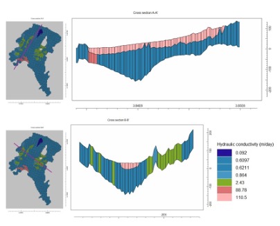
The Athens groundwater flow model covers the wider area of interest (Athens Metropolitan area), along Kifisos river, the major surface watercourse with ephemeral flow that discharges into the Mediterranean Sea. The hydrological units were divided in two different layers. The first layer represents the Quaternary deposits of Kifisos river and the latter layer is formed by the Neogene formation. In order to simplify the complex stratigraphy of the plain, a different zonation was considered for several geological formations with different hydraulic characteristics. Both aquifer layers are convertible.
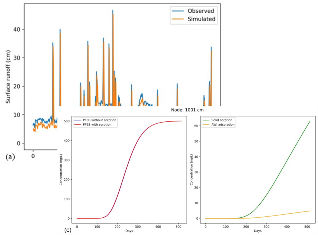
Application example: Perfluorobutanesulfonic acid (PFBS) movement in the unsaturated zone of Athens
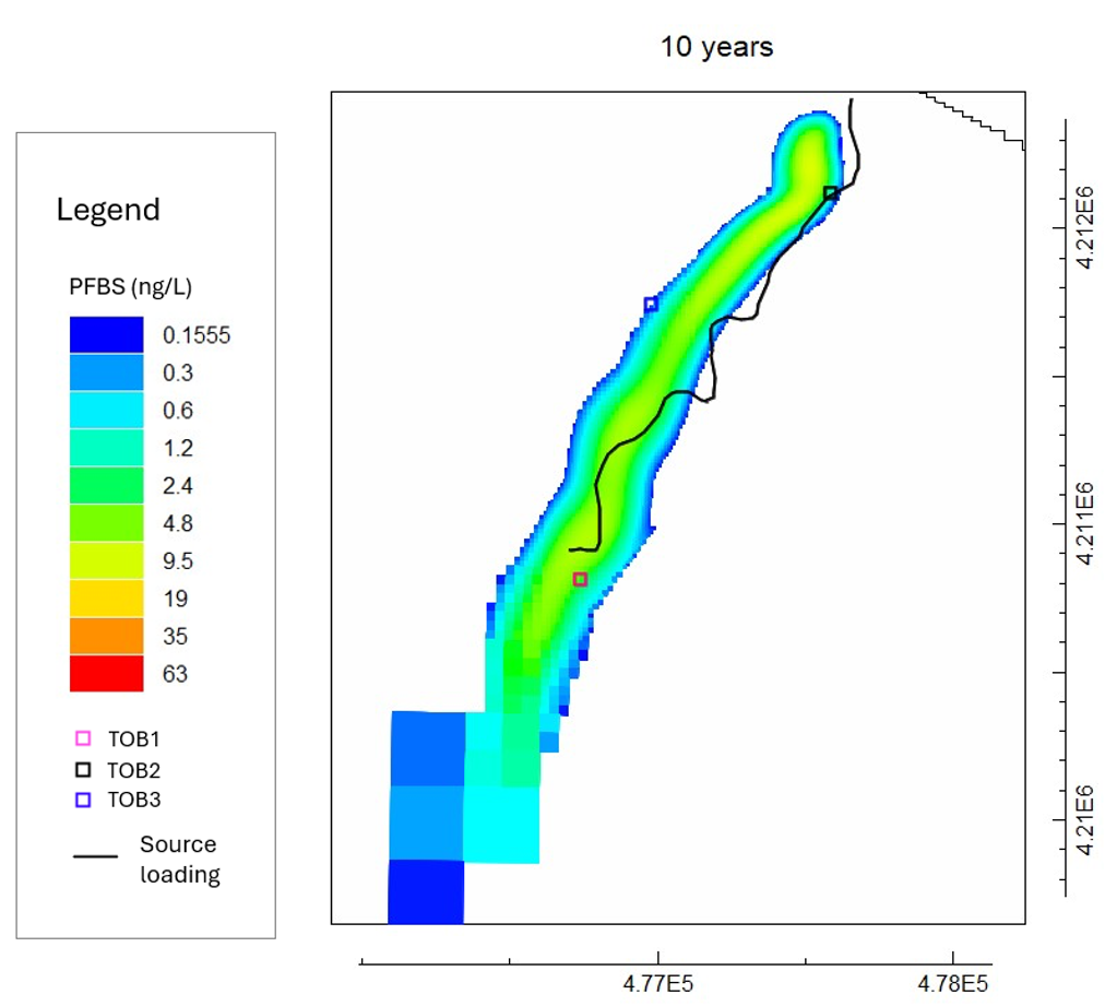
Application example: Perfluorobutanesulfonic acid (PFBS) movement in the Athens Groundwater
The model extends spatially along the boundaries of the Neogene formation and the hilly areas at the east (Imittos mountain) and the west (Egaleo mountain) while at the south, the model is bounded by the coastline (at Saronicos gulf). The inflows and outflows of the system are based on hydrodynamic conditions in the Athens plain. The groundwater model is coupled with an unsaturated zone model to identify the interactions of the urban aquifer with surface water and the unsaturated zone at the natural riverbed of Kifisos river. The unsaturated zone model incorporates the Air-Water Interface (AWI) adsorption process in free and open-source software, a vital process that defines Per- and polyfluoroalkyl substances (PFAS) transport in the subsurface.